| Name | Last Modified | Size | DAP Response Links | Dataset Viewers | |||||
|---|---|---|---|---|---|---|---|---|---|
| AIRS.2004.01.19.GranuleMap.Ascending.jpg | 2012-06-06T17:59:20GMT | 651042 |
|
||||||
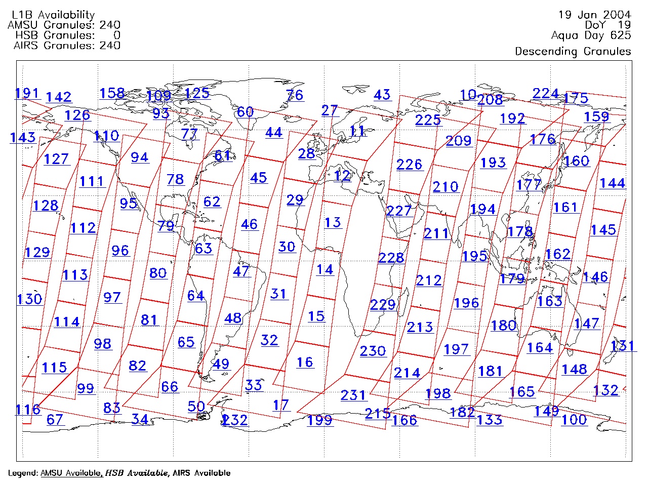
| AIRS.2004.01.19.GranuleMap.Descending.jpg | 2012-06-06T17:59:20GMT | 634592 |
|
||||||
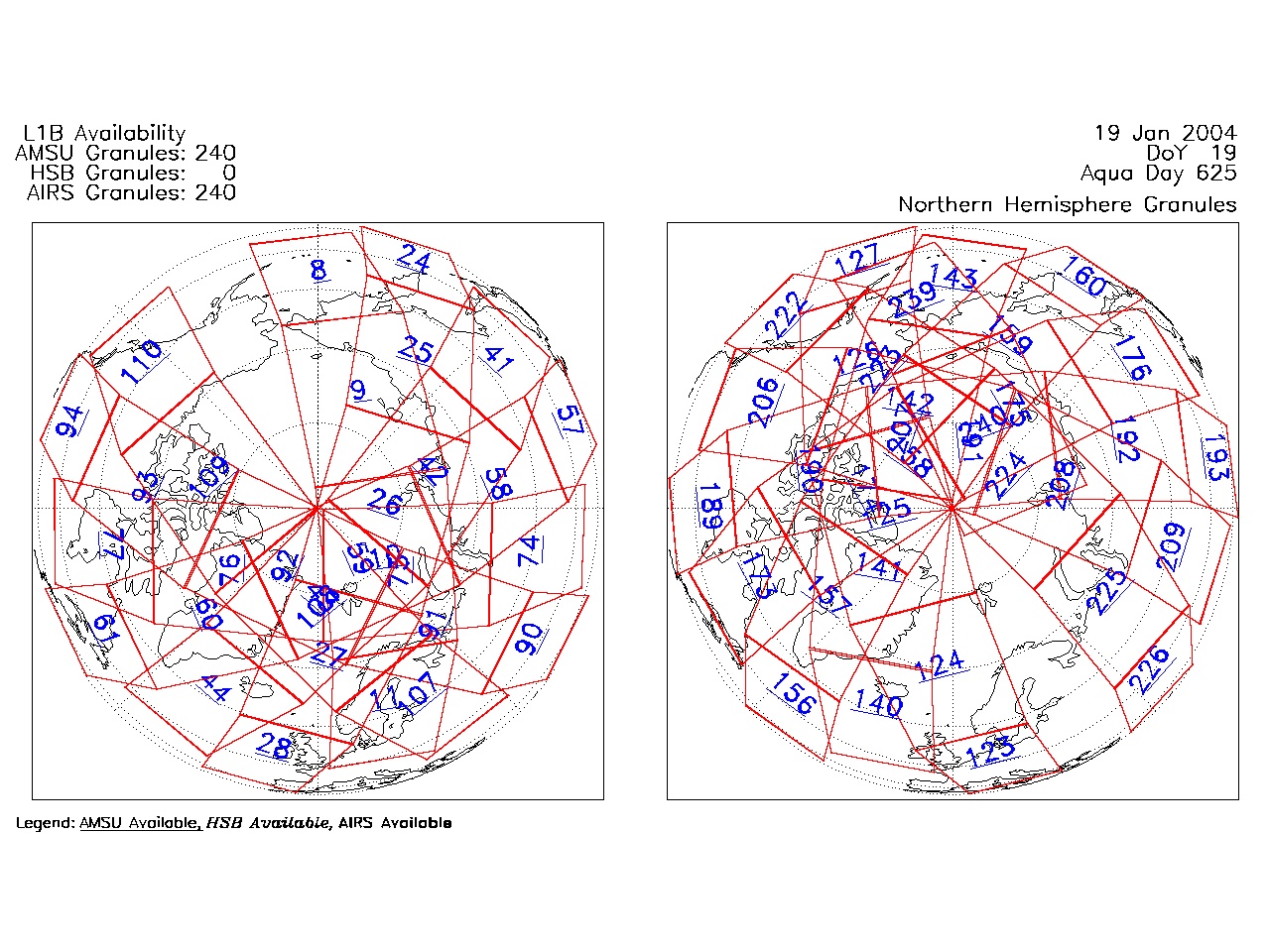
| AIRS.2004.01.19.GranuleMap.North.jpg | 2012-06-06T17:59:20GMT | 533416 |
|
||||||
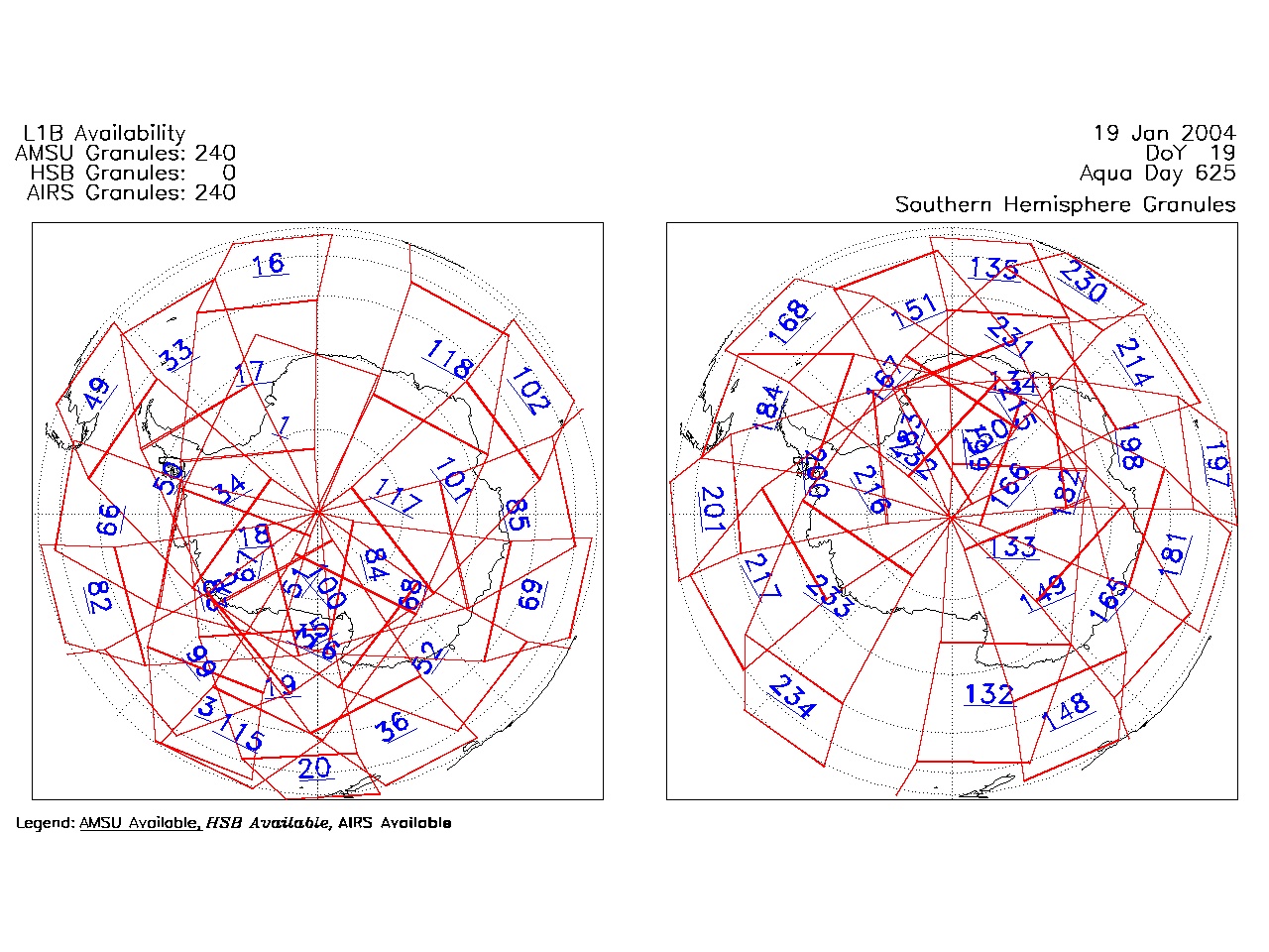
| AIRS.2004.01.19.GranuleMap.South.jpg | 2012-06-06T17:59:21GMT | 496784 |
|
||||||
| AIRS.2004.01.19.GranuleMap.pdf | 2012-06-06T17:59:20GMT | 333404 |
|
||||||
| AIRS.2004.01.19.GranuleMap.xml | 2012-06-06T17:59:21GMT | 2535 |
|
|
THREDDS Catalog XML
|