| Name | Last Modified | Size | DAP Response Links | Dataset Viewers | |||||
|---|---|---|---|---|---|---|---|---|---|
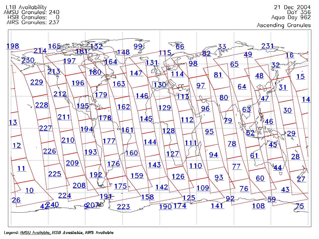
| AIRS.2004.12.21.GranuleMap.Ascending.jpg | 2012-06-06T18:08:49GMT | 621516 |
|
||||||
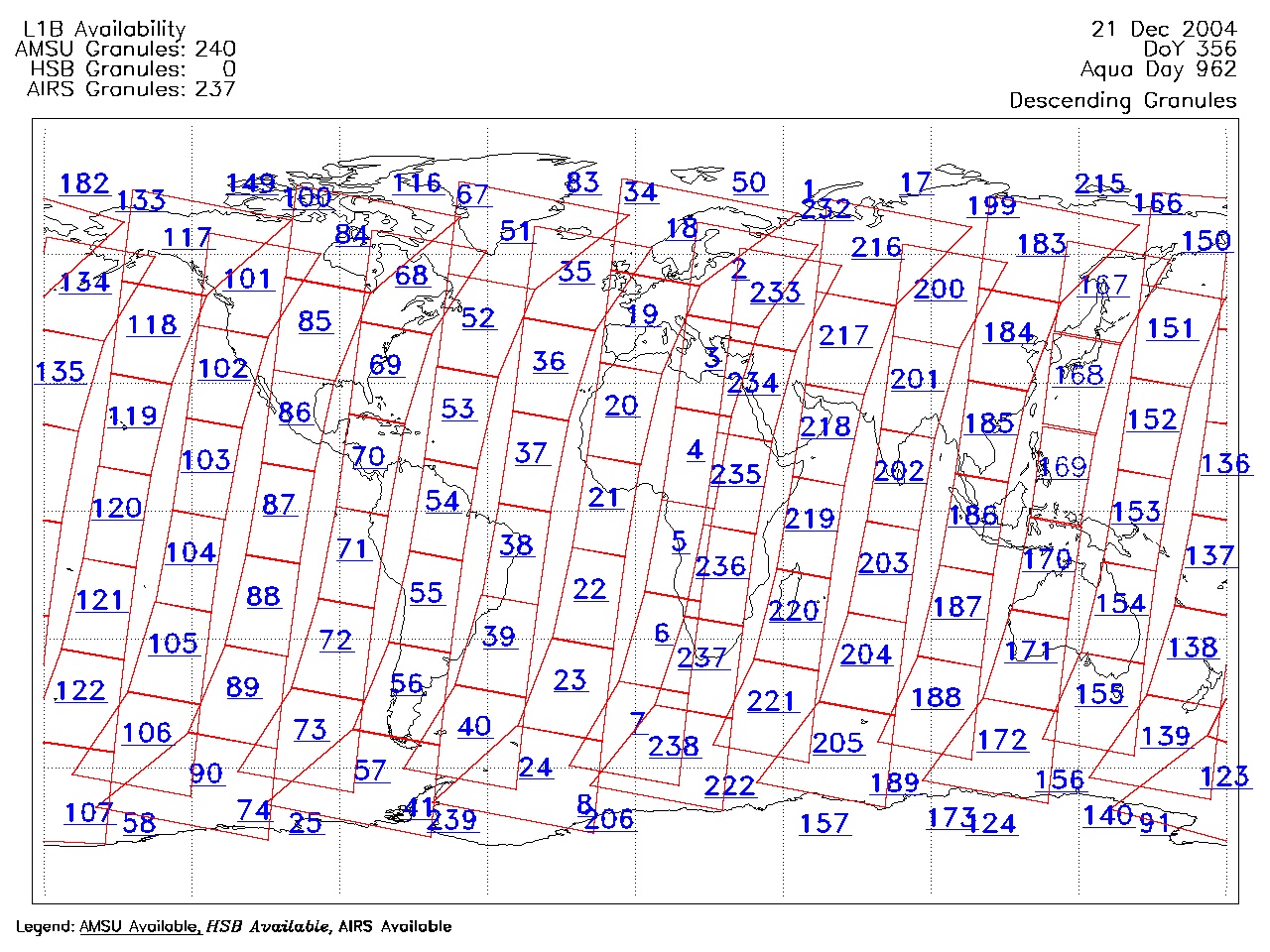
| AIRS.2004.12.21.GranuleMap.Descending.jpg | 2012-06-06T18:08:49GMT | 656032 |
|
||||||
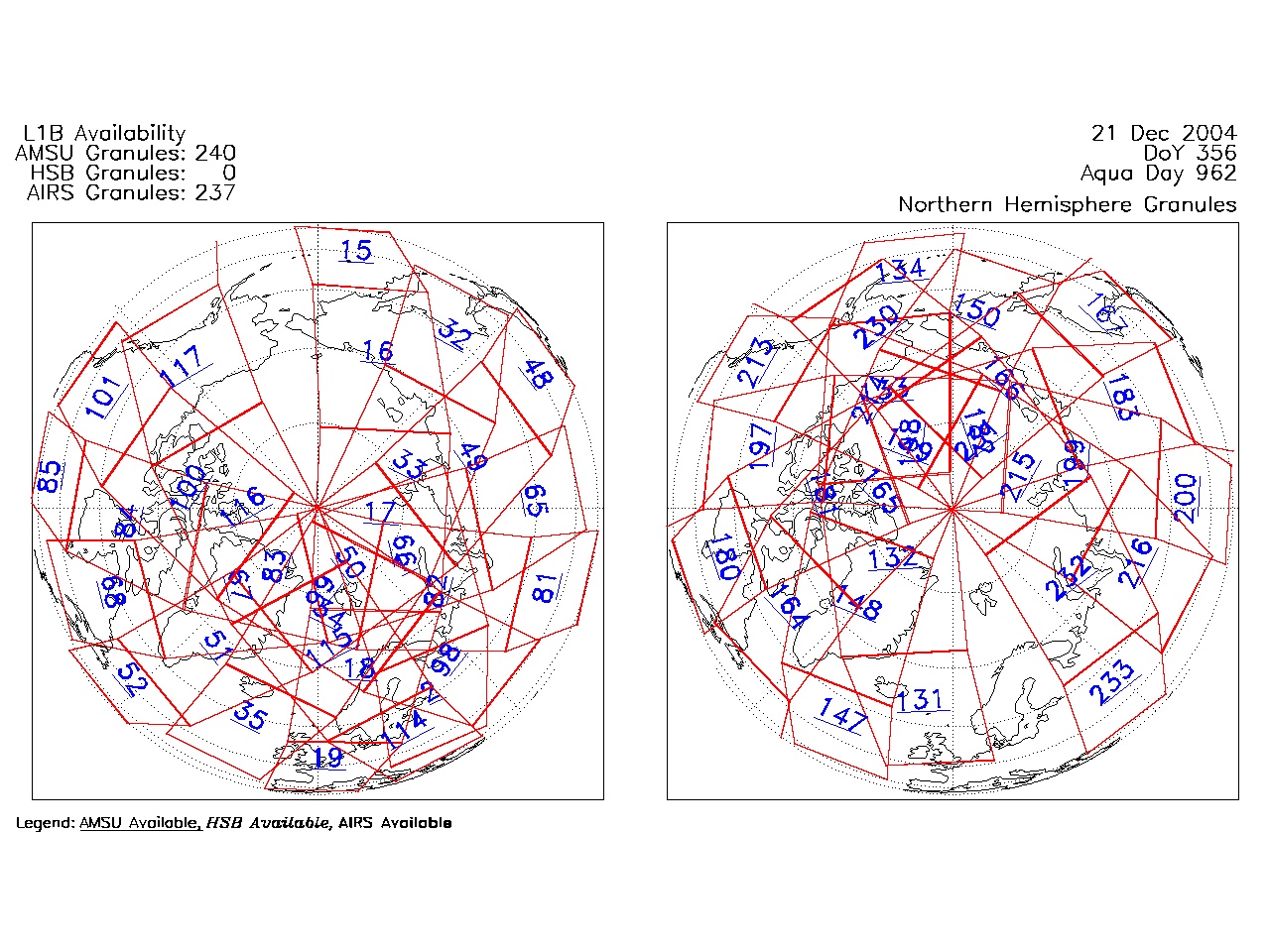
| AIRS.2004.12.21.GranuleMap.North.jpg | 2012-06-06T18:08:49GMT | 526368 |
|
||||||
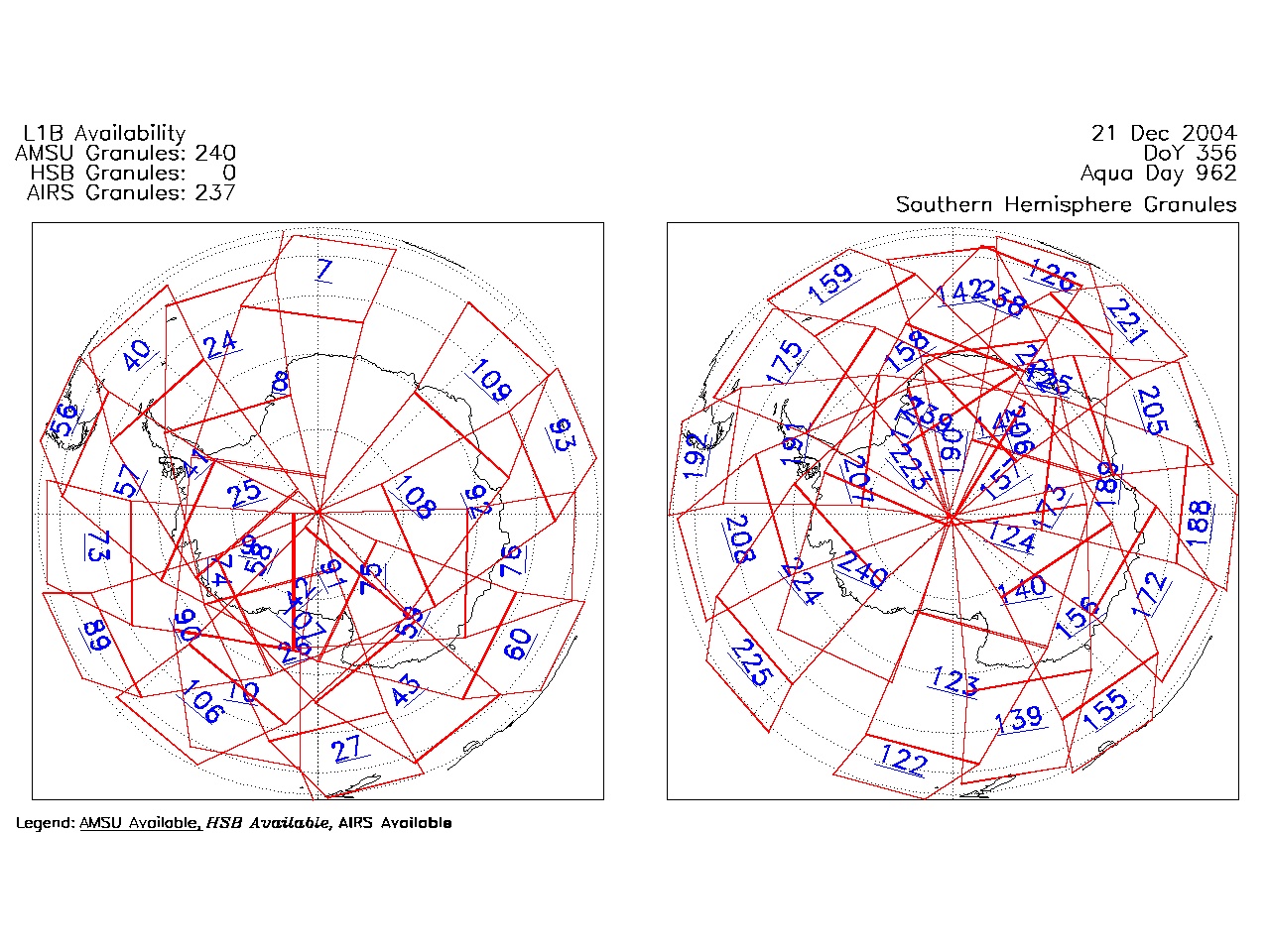
| AIRS.2004.12.21.GranuleMap.South.jpg | 2012-06-06T18:08:49GMT | 501893 |
|
||||||
| AIRS.2004.12.21.GranuleMap.pdf | 2012-06-06T18:08:49GMT | 333309 |
|
||||||
| AIRS.2004.12.21.GranuleMap.xml | 2012-06-06T18:08:49GMT | 2534 |
|
|
THREDDS Catalog XML
|